Bến Tre
Sightseeing
0/5
Overview
BEN TRE PROVINCE
Ben Tre is a province in the Mekong Delta, adjacent to the East Sea, with a 60 km long coastline. The north borders Tien Giang, the west and southwest borders Vinh Long, the south borders Tra Vinh. Ben Tre City is 85 km from Ho Chi Minh City.
Geography
Ben Tre has an area of 2,322 km². The southernmost point of the province is located on latitude 9o48' North, the northernmost point is located on latitude 10o20' North, the easternmost point is on longitude 106o48' East, the westernmost point is on longitude 105o57' East [3]. The province's population is 1,354,589 people (census April 1, 2009]) with the majority ethnic group being Kinh people.
The average annual temperature ranges from 26°C to 27°C. Average annual rainfall ranges from 1,250 mm to 1,500 mm. The climate here is tropical monsoon: the rainy season is from May to October, the remaining months are the dry season.
Ben Tre is a province with flat terrain, scattered with sand dunes (typically in An Thuan commune - Thanh Phu district, there is a sand dune even though it is about 15-20km from the sea) interspersed with fields and gardens, without forests. large trees, surrounded by water on all four sides with many rivers and canals.
Four branches of the Tien Giang river are My Tho river, Ba Lai river, Ham Luong river and Co Chien river, dividing Ben Tre land into An Hoa island (including part of Chau Thanh district, Binh Dai district), Bao island (including part of Chau Thanh district, Binh Dai district), Bao island (including part of Chau Thanh district, Binh Dai district), and Bao island (including part of Chau Thanh district, Binh Dai district). part of Chau Thanh district, Ben Tre city, Giong Trom, Ba Tri districts) and Minh island (including Cho Lach, Mo Cay north, Mo Cay south, Thanh Phu districts).
Two rivers, Ham Luong and Ba Lai, flow throughout the province and into two estuaries of the same name. My Tho River divides the northern boundary with Tien Giang province and flows to Dai Cua. Co Chien River forms the boundary with Tra Vinh province and flows out to two estuaries of Co Chien and Cung Hau. Other rivers and canals are Ben Tre river, Bang Cung canal, Thom canal, Tan Huong canal, Tien Thuy canal, Cau May canal, Vung Luong canal...
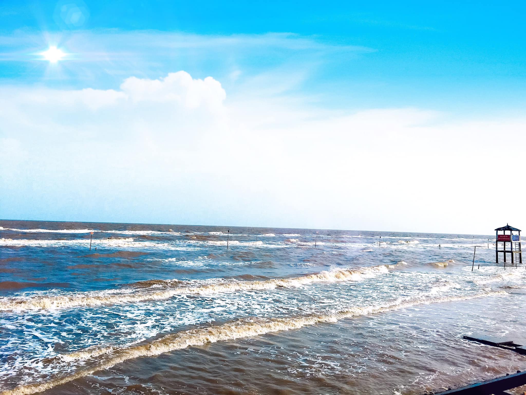
Ben Tre's coastline is about 60 kilometers long. Offshore there are small islands such as Con Loi, Con Ho...
History
Tỉnh Bến Tre vốn là một phần của dinh Hoằng Trấn lập ra năm 1803, năm sau đổi là dinh Vĩnh Trấn. Năm 1808 dinh này lại đổi là trấn Vĩnh Thanh. Tỉnh Bến Tre chính là vùng đất thuộc huyện Tân An (được nâng cấp từ tổng Tân An lên năm 1808), thuộc phủ Định Viễn (cũng được nâng cấp từ châu Định Viễn trong cùng năm), nằm trong trấn Vĩnh Thanh.
Năm 1823, huyện Tân An chia thành hai huyện Tân An và Bảo An, đặt dưới phủ Hoằng An (Bến Tre ngày nay).
Năm 1832, vua Minh Mạng bỏ trấn lập tỉnh, trấn Vĩnh Thanh chia thành hai tỉnh An Giang và Vĩnh Long. Tỉnh Vĩnh Long lúc bấy giờ gồm 3 phủ Hoằng An (Bến Tre ngày nay), Định Viễn (Vĩnh Long ngày nay) và Lạc Hóa (Trà Vinh ngày nay).
Năm 1837, đặt thêm phủ Hoằng Trị, rồi đến năm 1851, bỏ phủ Hoằng An, các huyện trực thuộc nhập cả vào phủ Hoằng Trị.
Năm 1876, Pháp chia Nam Kỳ thành 4 khu vực hành chính lớn, mỗi khu vực hành chính lại chia nhỏ thành các tiểu khu hay hạt tham biện (arrondissement administratif) thì Bến Tre là hạt tham biện thuộc khu vực hành chính Vĩnh Long.
Theo Nghị định ngày 20 tháng 12 năm 1899 của Toàn quyền Đông Dương đổi tên tất cả các hạt tham biện thành tỉnh thì từ ngày 1 tháng 1 năm 1900 hạt tham biện Bến Tre trở thành tỉnh Bến Tre.
Từ đó, bỏ cấp huyện mà chia thành quận. Tỉnh có 4 quận: Ba Tri, Sốc Sãi, Mỏ Cày, Thạnh Phú, với 21 tổng và 144 xã. Diện tích của tỉnh là 1501 km². Dân số năm 1910: 223.405 người, năm 1930: 286.000 người, năm 1943: 346.500 người, năm 1955: 339.000 người.
Thời Việt Nam Cộng Hòa, từ ngày 22 tháng 10 năm 1956, tỉnh Bến Tre đổi tên thành tỉnh Kiến Hòa và gồm 9 quận: Ba Tri, Bình Đại, Đôn Nhơn, Giồng Trôm, Mỏ Cày, Thạnh Phú, Hàm Long, Hương Mỹ, Trúc Giang, với 115 xã, 793 ấp (năm 1965), năm 1970 có 119 xã. Tỉnh lị gọi là Trúc Giang. Diện tích của tỉnh là 2085 km². Dân số năm 1965 là 547.819 người, năm 1970 là 582.900 người.
Từ năm 1975 tỉnh Bến Tre lấy lại tên cũ và chia thành các huyện.
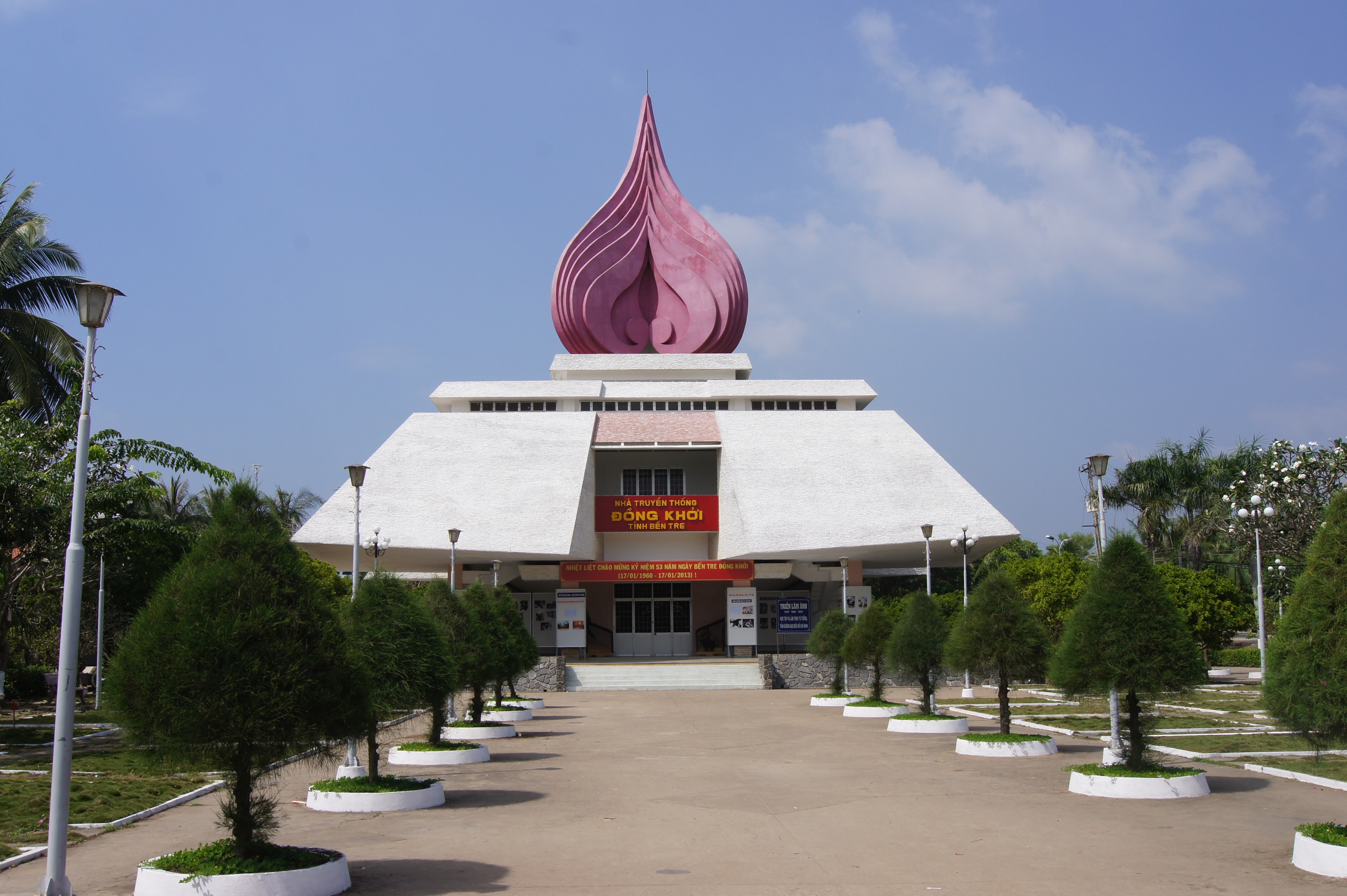
Bến Tre cũng là quê hương của Đạo Dừa. Trong thời Chiến tranh Việt Nam, Bến Tre được coi là quê hương "Đồng Khởi", mở đầu cho cao trào đấu tranh vũ trang của Mặt trận Dân tộc giải phóng miền Nam chống chế độ Ngô Đình Diệm, khốc liệt nhất là trong năm 1960.
Du lịch
Du lịch sinh thái
Ben Tre has favorable conditions to develop ecotourism, because it still retains the pristine features of the gardens, maintaining a fresh ecological environment in the green of coconut gardens and large fruit orchards.
Some famous tourist destinations are:
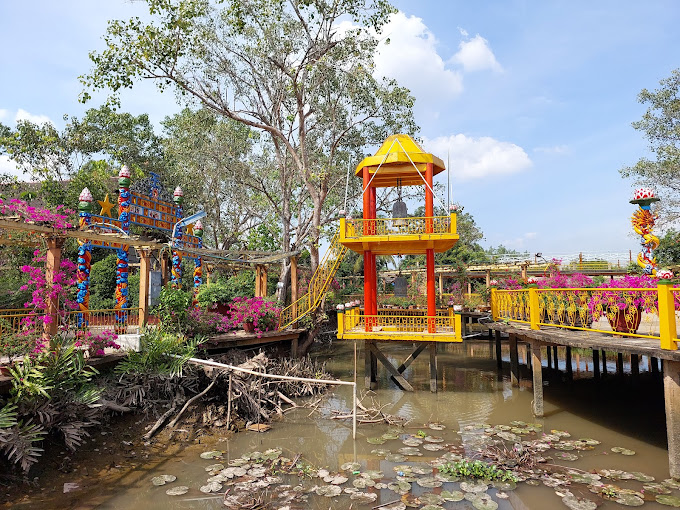
* Con Phung (Con Ong Dao Dua) in Tan Thach commune, Chau Thanh district, located on a floating island in the middle of the Tien River, has relics of the Coconut religion with architectural works. unique structure. On Con Phung there is also a craft village with products from coconut and honey.
* Con Oc (Con Hung Phong) is located in Hung Phong commune, Giong Trom district, with many coconut gardens and fruit orchards.
* Con Tien, in Tien Long commune, Chau Thanh district, is a beautiful sandy beach, every year on the 5th day of the 5th lunar month, tens of thousands of people come to bathe and have fun.
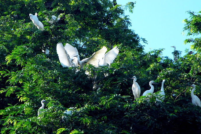
* Vam Ho Bird Sanctuary, located in My Hoa and Tan Xuan communes, Ba Tri district, is home to nearly 500,000 storks, egrets and other wild birds along with date palm forests and maple vegetation. rich in varieties of guava, soya beans, soursop, nipa, mangrove, hibiscus, dates, acanthus, sea spinach...
* Cai Mon orchard, Vinh Thanh commune , Cho Lach district
* Thua Duc beach in Binh Dai
There is also tourism on rivers and beaches such as Ngao beach, Ba Tri district.
Relics
In Ben Tre, there are also many Buddhist relics and graves of famous figures.
Famous pagodas in Ben Tre are Hoi Ton Pagoda, Tuyen Linh Pagoda, Vien Minh Pagoda. Hoi Ton Pagoda The pagoda was built by Zen master Long Thien in the 18th century in hamlet 8, Quoi Son commune, Chau Thanh district and was restored in 1805, 1884, 1947 and 1992.
Tuyen Linh Pagoda was built in 1861 in hamlet Tan Quoi Dong B, Minh Duc commune, Mo Cay district, and was renovated and expanded in 1924, 1941, 1983. Vien Minh Pagoda is located at 156, Nguyen Dinh Chieu street, Ben Tre town, with the Currently, it was built from 1951 to 1959.
Famous figures with graves here are Nguyen Dinh Chieu, Vo Truong Toan and Phan Thanh Gian and female general Nguyen Thi Dinh. The tomb of famous scientist Truong Vinh Ky is also in Ben Tre (Cai Mon - Vinh Thanh commune, Cho Lach District, Ben Tre Province).
Explore the place
The City Maps
Reviews
0/5
Not Rated
Based on
0 review
Excellent
0
Very Good
0
Average
0
Poor
0
Terrible
0
No Review
