Bình Định
Sightseeing
0/5
Overview
PACIFY THE PROVINCE
Geography
Binh Dinh is a coastal province in Central Vietnam. The province's territory stretches 110 km in the North - South direction, natural area: 6,025 km², territorial sea area: 36,000 km². The North borders Quang Ngai province, the northernmost point has coordinates: 14°42'10 North, 108°55'4 East. The South borders Phu Yen province, the southernmost point has coordinates: 13°39'10 North, 108°54'00 East. The West borders Gia Lai province, the westernmost point has coordinates: 14°27' North, 108°27' East. The East borders the East Sea with a 134 km long coastline, the easternmost point is Nhon Chau commune (Cu Lao Xanh) in Qui Nhon city, with coordinates: 13°36'33 North, 109°21' East.
Binh Dinh is considered to have a very important strategic position in the socio-economic development of the central key economic region, considered one of the gateways to the sea of the Central Highlands and southern provinces. Laos, northeastern Cambodia.
History
The ancient martial land of Tay Son Binh Dinh was thousands of years ago the residence of the Champa people. In the 15th century, the Le Dynasty established Hoai Nhon palace, and under Lord Nguyen Hoang, it was renamed Quy Nhon palace. In 776, Lord Nguyen Nhac built the Imperial Citadel in Quy Nhon.
In 1799, Nguyen Anh occupied the citadel and changed its name to Binh Dinh and became the center of the Nguyen Dynasty in the early 19th century. In 1890, the French colonialists merged Binh Dinh with Phu Yen, and in 1899 they separated. In 1913, Binh Dinh was merged with Phu Yen for Kom Tum province. In 1921, the two provinces were separated again.
In 1976, Nghia Binh province was established from the merger of two provinces, Quang Ngai and Binh Dinh. In 1989 Binh Dinh was re-established.
Climate
Binh Dinh has a humid tropical and monsoon climate. Average annual air temperature: in mountainous areas varies from 20.1 - 26.1°C; in coastal areas it is 27°C. Average monthly absolute humidity of the year: in mountainous areas is 22.5 - 27.9% and relative humidity is 79 - 92%; In coastal areas, the average absolute humidity is 27.9% and relative humidity is 79%. Total average annual rainfall is 1,751mm, maximum is 2,658mm, minimum is 1,131mm. The rainy season starts from September to December; The dry season lasts from January to August. The geological structure, topography, and climate make Binh Dinh, although it does not have a large plain, has fertile fields with a variety of agricultural, forestry, and fishery products... many mineral resources and hydroelectric potential.
Tourism
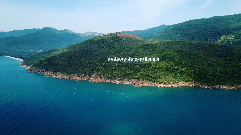
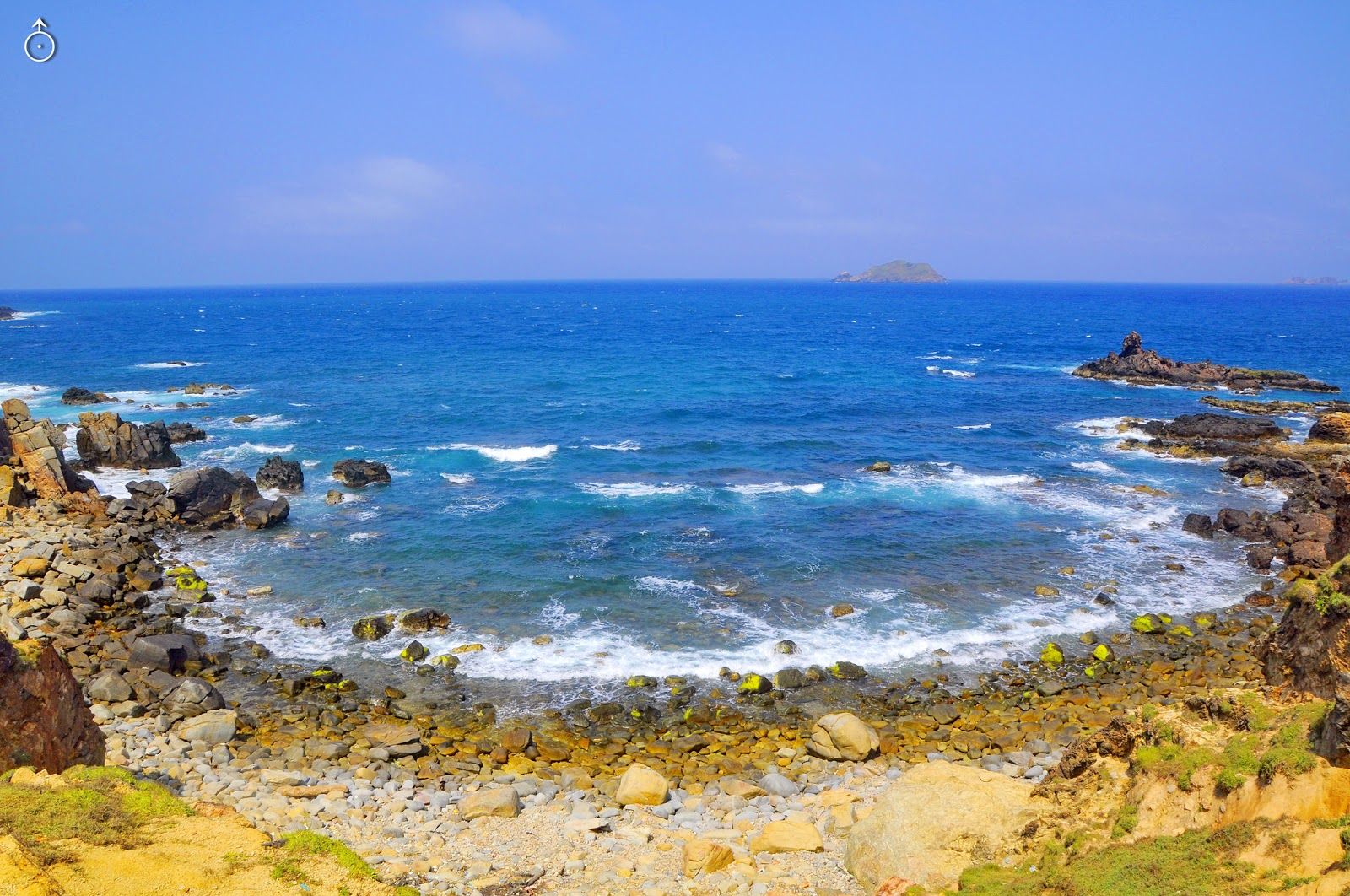
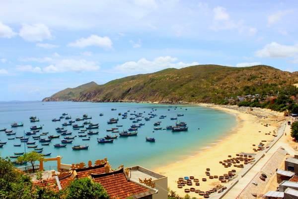
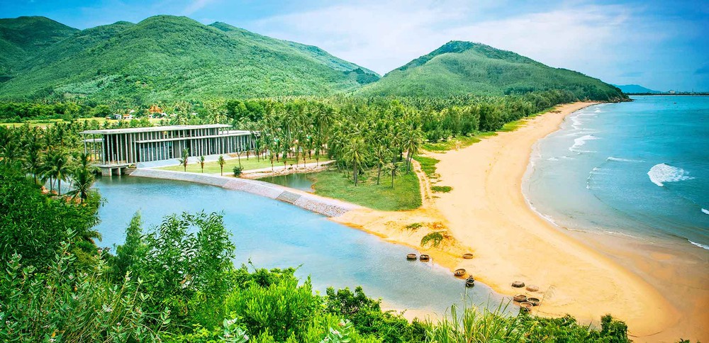
Mother Nature has also very kindly brought to Binh Dinh many beaches with wild beauty, deep blue water at the bottom and many smooth white sand beaches. It's wonderful that the mountains and seas of this place are full of beautiful scenery. Going up the mountain, we will enjoy: Ba Hoa mountain, Vung Chua mountain, Xuan Van mountain. Coming here, we can fully see the beauty of Quy Nhon city,... Once we go up the mountain, we must definitely explore the rivers, streams, waterfalls and rapids: the tunnel. Ho is the best choice, followed by: egg beach, queen beach, folding beach, bau beach, wild beach, Quy Nhon beach, Thi Nai lagoon, Eo Gio, Trung Luong...
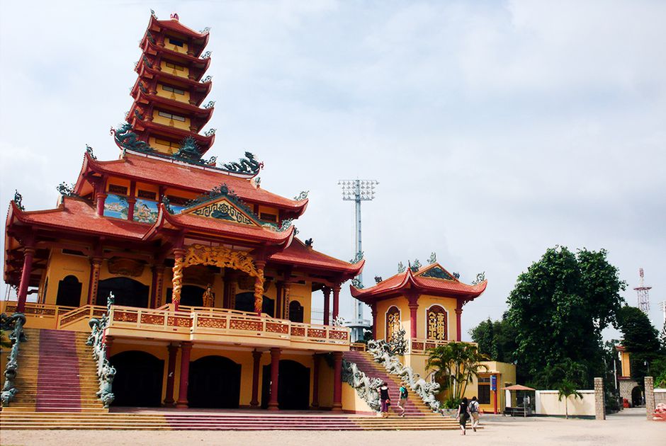
Anyone who has come to Binh Dinh cannot miss the stunningly beautiful Cham towers, because up to now there are still architectures containing many mysteries and is the second locality with the most Cham towers in our country. Such as: Banh It Tower, Twin Tower, Duong Long Tower, Binh Lam Tower, Canh Tien Tower, Thu Thien Tower,...
As one of the attractions that attracts many domestic and foreign tourists, in addition to the islands and Cham towers, these are the places that virtual living believers must definitely go once: Ham Ho eco-tourism area, Heaven Altar, Quang Trung Museum, Ong Nui Pagoda, Song Village Seminary, Ngoc Hoa Vihara, Thi Nai Bridge, FLC Zoo Safari Park, etc.
Traffic
Binh Dinh will continue to invest and develop a complete network of highways, national highways, and coastal roads according to national planning. Prioritize the construction of Quy Nhon - Pleiku expressway.
Building a provincial road system connecting highways and national highways to economic zones, tourist areas, key services, roads to industrial clusters, between urban and rural areas and connecting to other areas. nearby provinces.
The planning for developing the provincial road system to 2030 includes 16 routes, of which 02 routes remain unchanged; Adjust and extend 08 routes; planning for new construction of 06 routes. Investment planning to upgrade and build new roads in the western part of the province.
All highways, national highways, and provincial roads crossing major rivers are being built with new bridges to replace old bridges that are no longer suitable. Promote freight transportation services within the city in general and develop buses to Binh Dinh in particular.
Explore the place
The City Maps
Reviews
0/5
Not Rated
Based on
0 review
Excellent
0
Very Good
0
Average
0
Poor
0
Terrible
0
No Review
