Quảng Ngãi
Sightseeing
Overview
QUANG NGAI PROVINCE
Square: 5,152.7 km2.
Population: 1218,6 thousands people (2010)
City: Quang Ngai City.
Districts: Ly Son, Binh Son, Tra Bong, Son Tinh, Son Tay, Son Ha, Tu Nghia, Nghia Hanh, Minh Long, Mo Duc, Duc Pho, Ba To, Tay Tra.
OVERVIEW
Quang Ngai is located in Central Vietnam, at an almost equal distance from the two ends of the country. Like other provinces in this area, Quang Ngai is characterized as having mountains on one side and the sea on the other. The population consists of a majority of Kinh people.

HISTORY
The ancient Sa Huynh culture inhabited what is now Quang Ngai. Remains of it were found in Sa Huynh in Duc Pho District in southern Quang Ngai province. Within Champa, the region that is now Quang Ngai was less significant than its powerful neighbours to the north and south (in Quang Nam Province and Vijaya in Binh Dinh Province). There are only a few Cham remains in the province. The area became part of Vietnam together with Vijaya (Binh Dinh Province) in 1471.
In the early 19th century the Long Wall of Quang Ngai was constructed in the province. It improved security among the Vietnamese and Hre people and facilitated trade.
Quang Ngai Province has long been particularly resistant to foreign occupiers. It was one of the first provinces in central Vietnam (together with Quang Tri Province) to organize self-defence forces in March 1945, with the famous Ba To Guerilla Unit mobilizing tens of thousands of peasants.
Quảng Ngãi Province was known as an NLF (Vietcong) stronghold during the Vietnam War and was the site of the infamous Binh Hoa massacre, Dien Nien-Phuoc Binh Massacre in 1966 and My Lai Massacre in 1968, as well as Operations Malheur I and Malheur II and Operation Quyet Thang 202. It produced famous war literature on both sides of the conflict: The now-famous wartime diary of NLF medic Đặng Thùy Trâm was written here, and from an American perspective, Quảng Ngãi Province is the major setting of Tim O'Brien's The Things They Carried.
GEOGRAPHY
Located on South-Central Vietnam, Quang Ngai borders Quang Nam Province on the north, Binh Dinh Province on the south, Kon Tum Province on the west and East Sea on the east with 135km seaside.
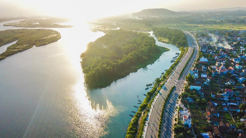
The province is surrounded by Truong Son Mountains on one side and the East Sea on the other. As a result, the topography includes mountains, plains, seaside and offshore islands. The main rivers are Tra Khuc, Tra Bong, and Ve rivers.
CLIMATE
The rain season lasts from September to December. It is hot between April and August and the weather is cold from January to March. Annual average temperature is 26ºC.
TOURISM
Quang Ngai is famous for the cultural vestiges of Chau Sa Citadel, Ong and Mai Son pagodas. The beautiful landscapes are An Mountain, Thien An Mountain and Tra Khuc River, Co Luy Commune under coconut trees, Sa Huynh and My Khe beaches.
Sa Huynh Beach is well-known with clear water, golden sand and pine trees. My Khe Beach is the most beautiful beach in Central Vietnam. It has fine white powdery sand, gently waves and poplars forest.
Coming to there, tourists have chance to visit old battlefields with popular names like Ba To, Tra Bong, Ba Gia, Van Tuong and Son My.
TRANSPORT
Quang Ngai City is 100km from Hoi An, 131km from Da Nang, 174km from Qui Nhon, 238km from Hue, 860km from Ho Chi Minh City, and 889km from Hanoi. National Highway No.1A and North-South Express Train runs through the province. National Highway No.24A links Quang Ngai to Central Highlands and Laos.

